A real, reproducible case study in AI-powered, data-driven prospecting for a niche service business — every number pulled from public records, not thin air.
I love niche lead generation businesses. For as long as we have had boberdoo, we have always had a couple clients doing something different. Even if a niche lead vertical is untapped, that does not mean there are no problems. Often the biggest hurdle is education. What is a lead? What I am supposed to do? What expectations should I have with this customer?
The idea for this series of articles came from my "fish guy" who has helped me over the years try and make my bass lake better. He is not technical and recently had his website go down (and stay down) and he asked me for some help. I know he was thinking just to get the website back up, but my mind wandered.... what could AI do to help him find more customers?
Part 1 of a 4-part series on AI-powered, top-of-funnel lead generation for service businesses.
The hardest part of lead generation is the top of the funnel
Ask any owner of a service business where their pipeline breaks and most point to the same place: the very top. Closing is a skill. Nurturing is a system. But finding the right people to talk to in the first place — the top of the funnel — is where most small and mid-sized companies quietly bleed time and money. They buy shared lists that three competitors already called, boost a few social posts, and hope.
This is a case study in doing the opposite. Over roughly one working day, we used AI and publicly available geospatial data to build a first-party, exclusive prospect list of 694 lake and pond owners across seven Northwest Indiana counties — for a pond and fish management service whose ideal customer invests more than $2,500 a year in their water.
No purchased list. No scraping of paywalled databases. Public records, a repeatable method, and an AI assistant doing the heavy lifting a research analyst would normally charge for.
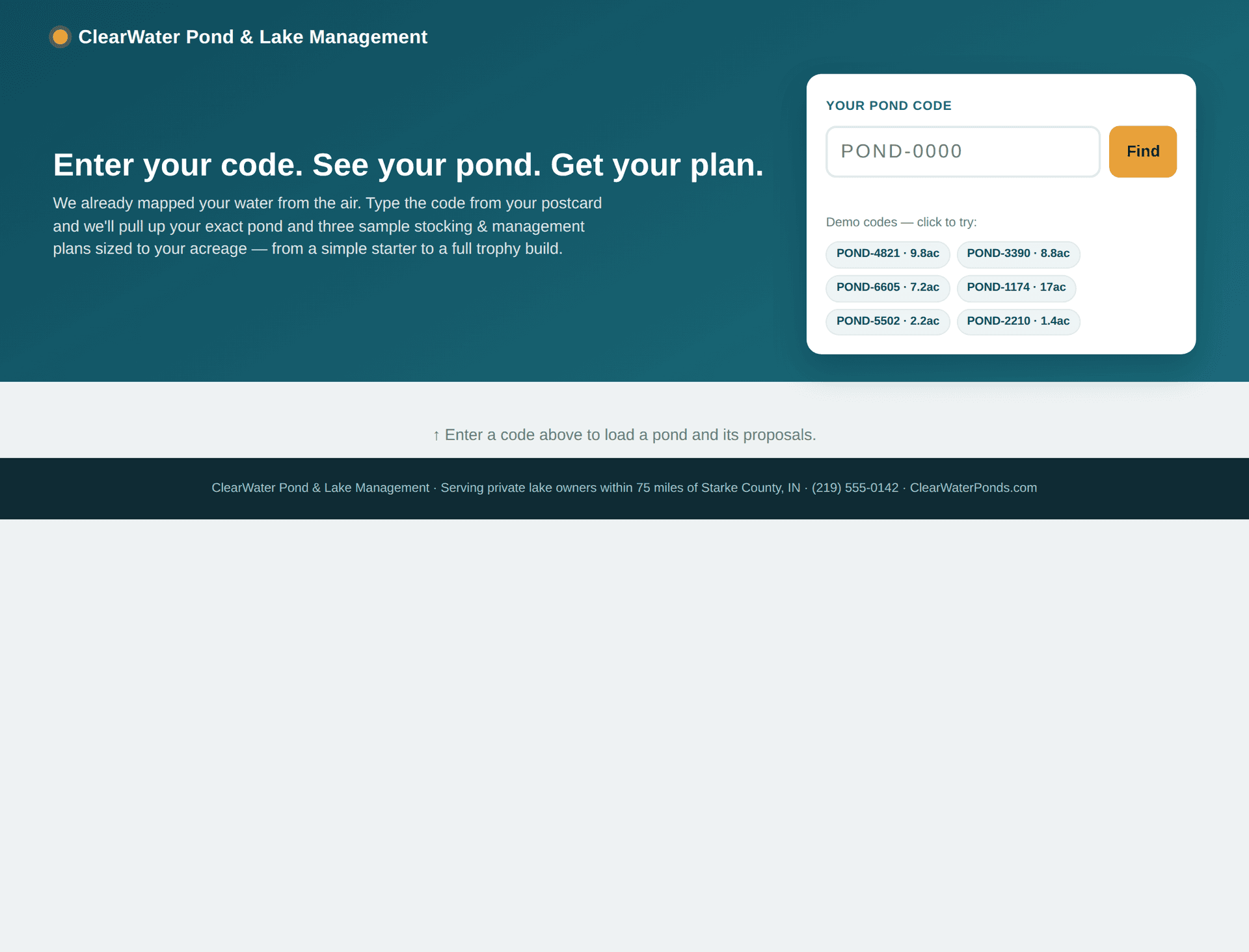
This is Part 1: what we built and how. Part 2 turns the list into a self-tracking direct-mail campaign, Part 3 takes the same data online across a 75-mile radius, and Part 4 hands each owner a personalized proposal with their own water on it.
Why pond owners are a perfect test case for AI lead generation
Most "AI lead generation" content is vague because most products are vague. This wasn't. It worked because the ideal customer shares one concrete, mappable trait:
They own a lake.
A pond isn't a mood or an intent signal. It's a physical asset sitting on a specific parcel of land, recorded in public data, visible from a satellite. If your best customer owns a findable asset, you don't have to guess who they are. You go get a list of every one of them.
That single insight is the whole playbook, and it generalizes far beyond ponds. Solar installers, roofers, tree services, dock builders, equestrian suppliers, pool companies, agricultural vendors — any business whose customer owns a mappable thing can run this exact process. Pond management just happens to be an unusually clean example.
Step 1 — Find every lake (2,427 of them)
We started with the U.S. Geological Survey's high-resolution hydrography data (the National Hydrography Dataset), hosted by the State of Indiana, and filtered every waterbody to those 1 acre or larger — in the data's units, a threshold of 0.00404686 square kilometers.
Across the seven-county Northwest Indiana region, that returned:
- Lake — 845
- LaPorte — 649
- Porter — 564
- Jasper — 109
- Newton — 101
- Starke — 87
- Pulaski — 72
- Total — 2,427
2,427 lakes and ponds — the entire addressable universe for a pond service in this market, defined in an afternoon. Not an estimate. A count.

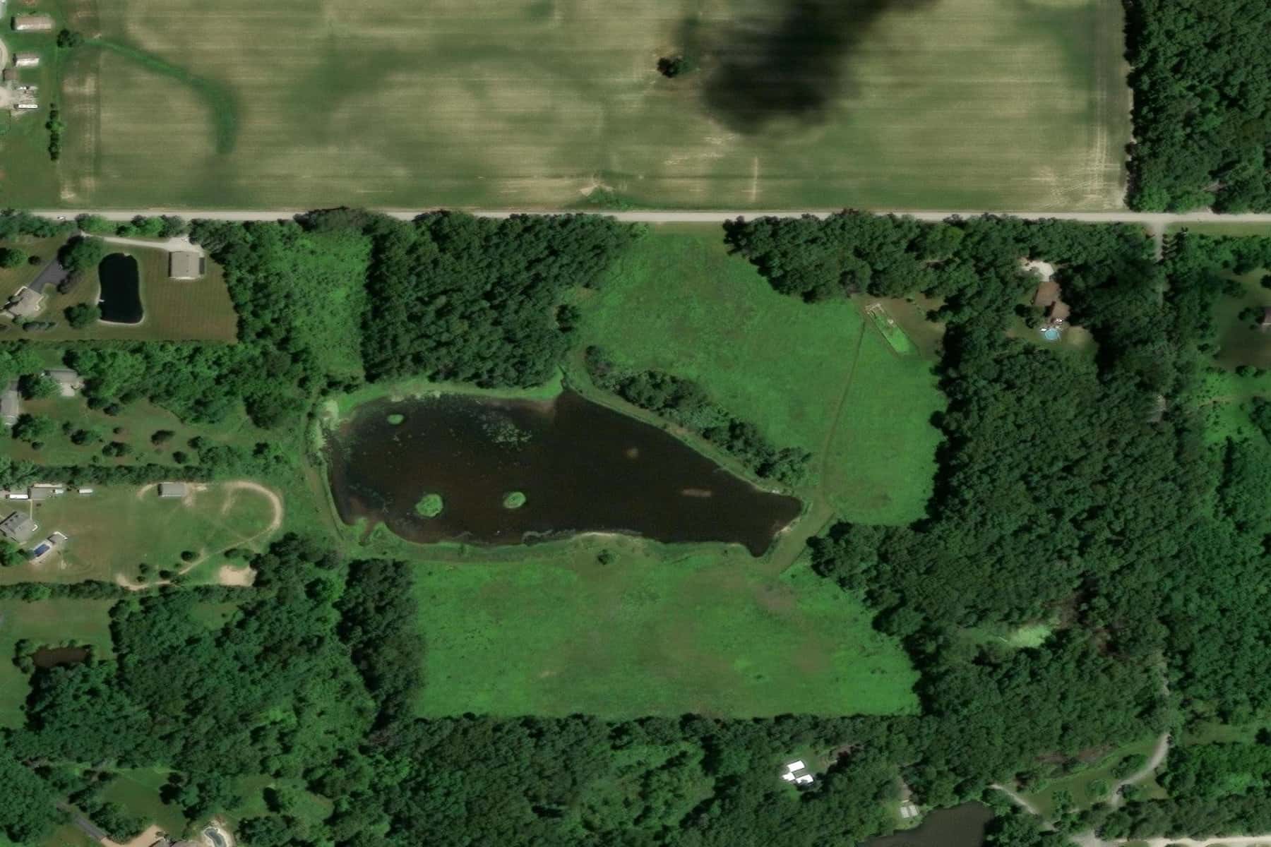
A 7.2-acre pond outside Valparaiso, isolated from the hydrography layer. Every one of the 2,427 waterbodies started as a polygon like this — a mappable asset, not a guess. (Esri World Imagery / Maxar / USDA FSA.)
Step 2 — Figure out who owns each one
A lake on a map isn't a lead. We needed the parcel — the piece of property — each lake sits on, and then how many owners surround it.
Using the State of Indiana's statewide parcel boundary layer, we ran a spatial join: for every lake polygon, find every land parcel that physically touches the water. The scale is real — LaPorte County alone contains 64,660 parcels. Each parcel record carries a parcel_id, a state_parcel_id, a property address, a latitude/longitude, and a state property-class code — but, notably, no owner name. Owner names live at the county level, which is where Step 3 gets interesting.
We sorted each lake into one of three buckets based on how many owners share it:
- Prime — single owner (one parcel touching the water). One person or family controls the entire pond. The best customers: one decision-maker, full authority, skin in the game.
- Likely — two to three owners. Small shared lakes. Still workable — one or two conversations.
- Community — four or more owners. Subdivision and association lakes, typically run by an HOA. A different, much harder sale.
That segmentation is the difference between a mailing list and a targeted one. Across the region we identified 1,364 single-owner lakes — the core market — cleanly separated from the community lakes that would only waste postage.

A 1.4-acre pond in Hebron (Porter County). The method doesn't only find trophy lakes — even a small backyard pond has a parcel, an owner, and a mailing address behind it. (Esri World Imagery / Maxar / USDA FSA.)
Step 3 — Pull owner names and strip out everyone who isn't a customer
This is where most DIY efforts stall, and where it gets interesting. Owner names and mailing addresses are public record, but every county publishes them differently. So we met each county where it lives:
- Porter County runs its own live parcel service (the County Auditor's ArcGIS) that publishes owner name, mailing address, property address, and — critically — the assessed value of the home on the parcel, updated daily. It's the only county in the set with a published wealth figure, and we used it.
- Lake County runs a separate mapping service whose parcel IDs don't match the state's, so we linked owners to lakes by geographic location instead — a point-in-polygon match that resolved 334 owners with zero failed lookups.
- Starke and Pulaski counties use a third, proprietary GIS platform with no standard interface. We reverse-engineered its internal map "identify" call and pulled owners one careful request at a time. Neither county publishes a mailing address, so those prospects are scored on lake size, owner type, and how many lakes the owner holds.
In total, we retrieved more than 1,095 owner records automatically from live county systems in a matter of hours — before we even got to the two counties that fought back (Step 3b).
Then came the filter that makes a list actually valuable. A striking share of "single-owner lakes" aren't owned by people at all — they're retention ponds owned by cities and townships, state Department of Natural Resources water, HOAs, developers, quarries, and industrial firms. In Lake County, roughly 7 of every 10 single-owner lake parcels — 241 of 334 — turned out to be institutional or commercial and were removed. In Porter County we stripped out 89 institutional owners. None of them will ever buy pond fertilization or fish stocking.
Step 3b — The two counties that fought back (and how we got in)
Here's the honest part, and it's a better story than "we hit a wall" — because we didn't stop at the wall.
Jasper and Newton counties don't publish owner data on their own systems at all. It lives only inside Beacon (Schneider Geospatial), a third-party parcel portal. Beacon's parcel search accepts only a local 10-digit parcel number that isn't in any free dataset — and it flatly rejects the state's parcel numbers. We tried every format. All failed. If you stop there, you write the section most "AI case studies" write: automation has limits, email the assessor, move on.
We didn't stop there. The way through had three steps:
- Pull each lake parcel's property street address from the state parcel layer we already had.
- Search Beacon by address — its address search is open, even though its parcel search isn't.
- The returned owner report lists the state parcel number as an "Alternate ID." So we matched each result back to our exact parcel by that state number — no guessing, no fuzzy matching.
That recovered an owner for every residential and farm-residence parcel that had a real, house-numbered street address. The very first parcel the client had personally tried and failed to find in Beacon ("came up with no results") resolved cleanly through the address route to a named local owner. The method beat the portal's own search box.
The honest limit that remains — and this is the part that makes the whole piece credible: parcels with no street address can't be matched this way. Vacant land, quarries, a landfill, municipal ponds, bare-road agricultural parcels — they have a parcel number but no house number, so there's nothing to search Beacon by. Those were left out. After searching 37 addressable parcels in Jasper and 24 in Newton and removing 11 institutions (fish and swine-farm LLCs, The Nature Conservancy, a couple of family limited partnerships), we added Jasper 32 + Newton 18 = 50 new scored prospects.
So the accurate claim isn't "every parcel." It's **every addressable residential lake parcel.** Knowing exactly where the method stops — and saying so — is part of doing this responsibly.
Step 4 — Score each remaining owner for fit
A name is not a priority. So every surviving prospect was scored on the traits that predict a high-value pond customer:
- Wealth signal. Where the county publishes it, we used the assessed value of the owner's home as a direct proxy — Porter's top local prospects sit on lakefront homes assessed between $700,000 and $1.25 million. Where it isn't published, we used the affluence of the owner's mailing ZIP code.
- Absentee / second-home signal. When an owner's mailing address differs from the lake's location, that's a second-home or investment owner — often the easiest sale, because they want someone to manage the water while they're away. The list surfaced owners mailing in from Wayzata, Minnesota; Fort Myers, Florida; Peoria, Arizona; La Grange, Illinois; and Chicago — plus, once Jasper and Newton came online, from as far as Culver City, California; Shorewood, Wisconsin; and Wheaton, Illinois — all holding lakes in rural Indiana.
- Lake size. Bigger water, bigger annual spend.
- Portfolio / multi-lake ownership. The system flagged repeat owners automatically. One family trust in Pulaski County holds five separate lake parcels; several owners in Starke County hold two or three each. A single conversation there could land multiple contracts.

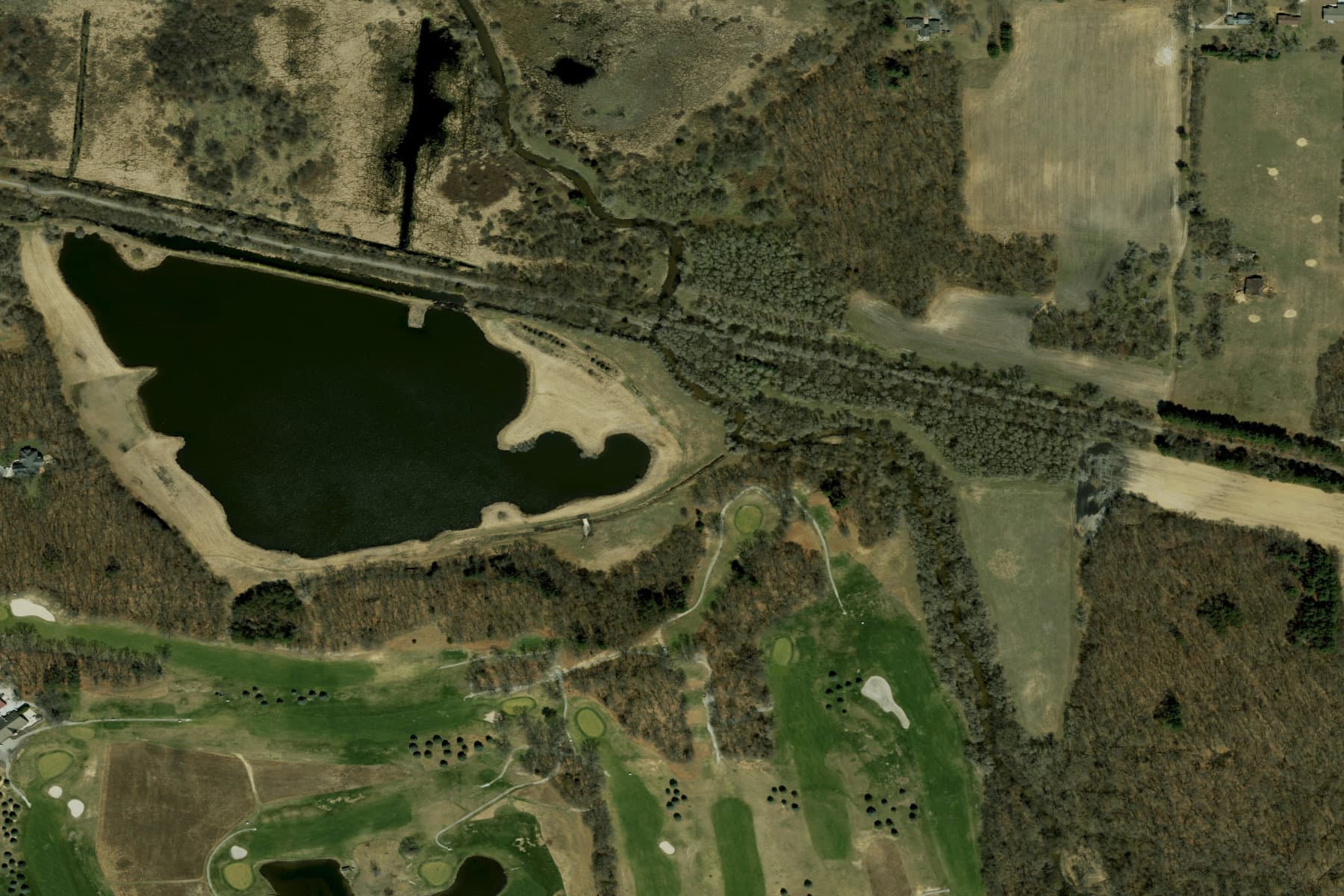
A 17-acre private lake near Winamac (Pulaski County). Lake size is a scoring input for a reason — bigger water means a bigger annual program. This one belongs to a multi-lake owner. (Esri World Imagery / Maxar / USDA FSA.)
The result: 694 exclusive, ranked prospects across all 7 counties
- LaPorte — Owner-data source: County assessor export; Scored prospects: 317
- Porter — Owner-data source: County Auditor ArcGIS (live), incl. home value; Scored prospects: 131
- Lake — Owner-data source: County GIS (live, geo-linked); Scored prospects: 93
- Pulaski — Owner-data source: Proprietary county GIS (live); Scored prospects: 57
- Starke — Owner-data source: Proprietary county GIS (live); Scored prospects: 46
- Jasper — Owner-data source: Beacon address-route (state-parcel matched); Scored prospects: 32
- Newton — Owner-data source: Beacon address-route (state-parcel matched); Scored prospects: 18
- Total — Owner-data source: —; Scored prospects: 694
Every one of the 694 comes with the owner's name, mailing address (where the county publishes it), the lake's size in acres, a wealth and absentee read, a fit score, and a one-click satellite link to their exact pond. They're ranked, so outreach starts with the roughly 120 highest-scoring "A-list" owners across the seven counties — not a random dial-down through a spreadsheet.
Why this is a repeatable AI lead-generation playbook
Strip out the ponds and the pattern is universal, which is why it belongs in every service marketer's toolkit:
- Define your customer by a mappable asset, not a vague persona.
- Find every instance of that asset in public geospatial data.
- Join it to ownership records and segment by decision-maker.
- Filter out institutions that will never buy.
- Score for fit using wealth, absentee status, size, and portfolio signals.
The output isn't a shared, resold, aged list. It's an exclusive, first-party audience you own, built at the cost of public-records access rather than per-lead pricing. For anyone in the lead-generation business, that distinction is the whole game: exclusive beats shared, first-party beats rented, and ranked beats random.
And it scales. This ran across 7 counties in a day. The same process runs across a state, or a region, or every county your trucks can reach — because the data model doesn't change, only the boundary box does.
Coming in Part 2: turning 694 names into booked jobs
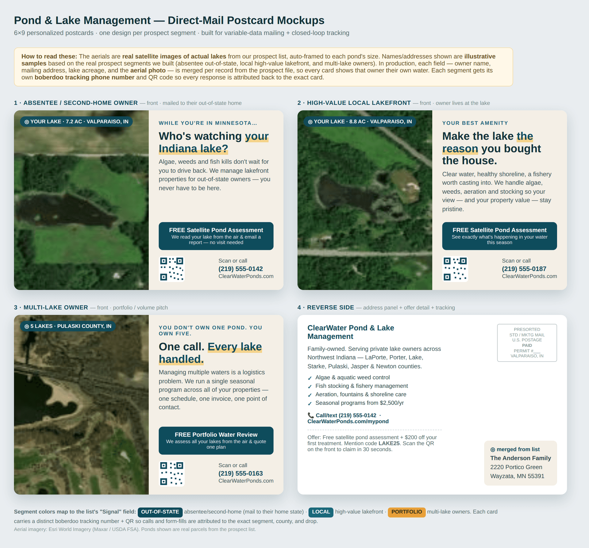
A list is potential energy. Part 2 converts it — and this is where owning the right data pays off, because we can market to these owners in ways a generic list never could. The single highest-leverage play: variable-data direct mail that shows each owner their own pond — a 6×9 postcard reading "We noticed your 8.8-acre lake off Mander Road" with an aerial of their exact water, split by segment (absentee, local high-value lakefront, multi-lake owner), and built to track itself so every response traces back to a postcard, a segment, and a county.
In Part 1, AI did in a day what a research analyst would bill a week for: it turned 2,427 dots on a map into 694 named, ranked, reachable prospects. The top of the funnel — the part everyone says is the hardest — is now the part that's finished.
Part 1 of a 4-part series on AI-powered, top-of-funnel lead generation for service businesses. All figures are drawn from public geospatial and property records for the seven-county Northwest Indiana region. Aerial imagery: Esri World Imagery (Maxar / USDA FSA).